
More Watershed Maps
A watershed is an area of land where water from streams, springs, and wetlands all flow to a common larger body of water, such as Cayuga Lake. The Cayuga Lake Watershed covers nearly 870 square miles, includes 50 municipalities, and is spread over 7 counties.
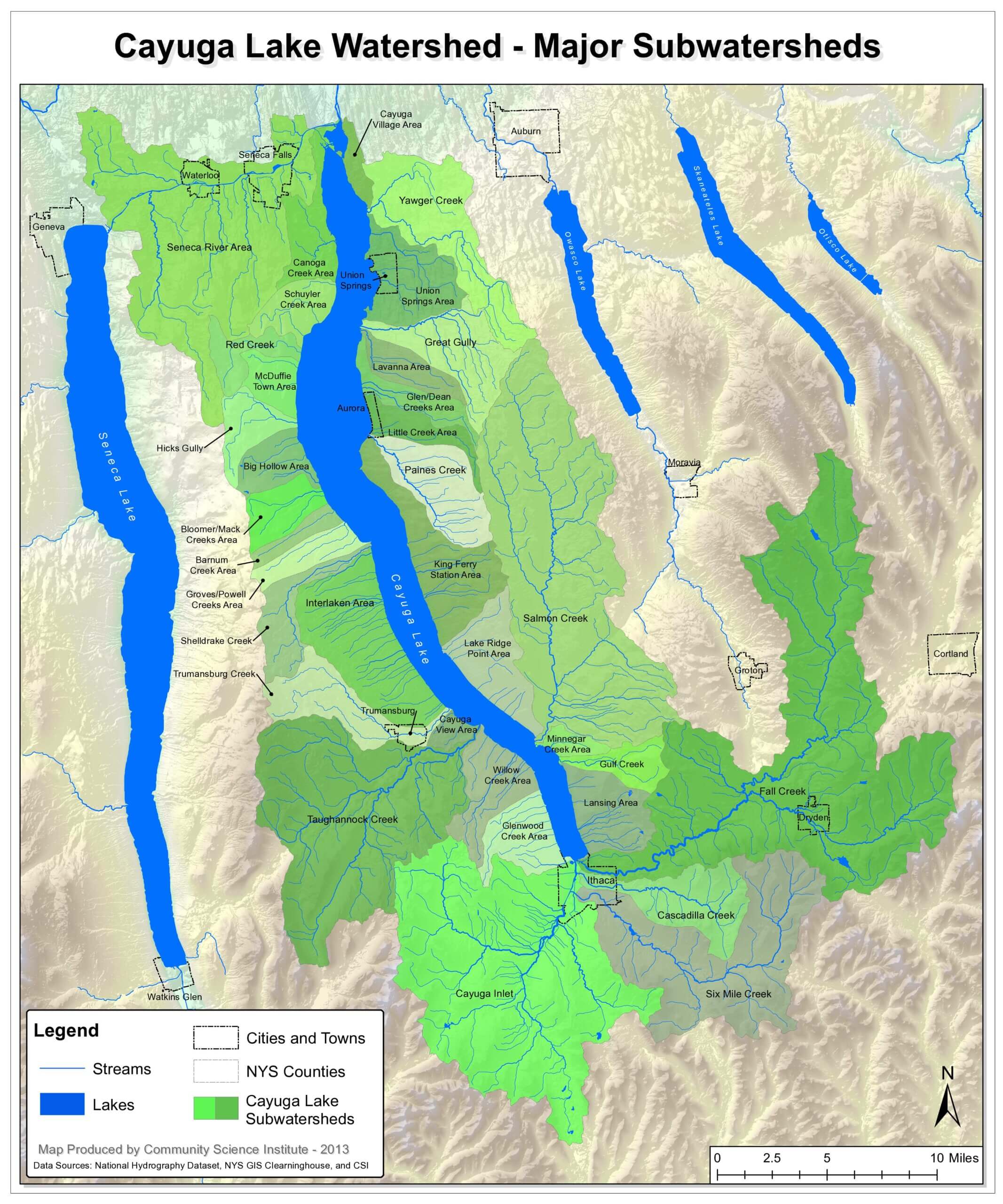
For larger version of the map above, click on the image to open it in a new tab or see clickable downloadable 2.3 MB file on the right. You can save it to your own computer, print it, etc. Thanks to Matt Yarrow and our friends at the Community Science Institute for this beautiful map.
Click to see/download/print the beautiful Cayuga Lake Watershed Map in the Downloads section on the right or bottom of the page. No boundaries – just the watershed set in the physical landscape. Thank you Karen Edelstein.
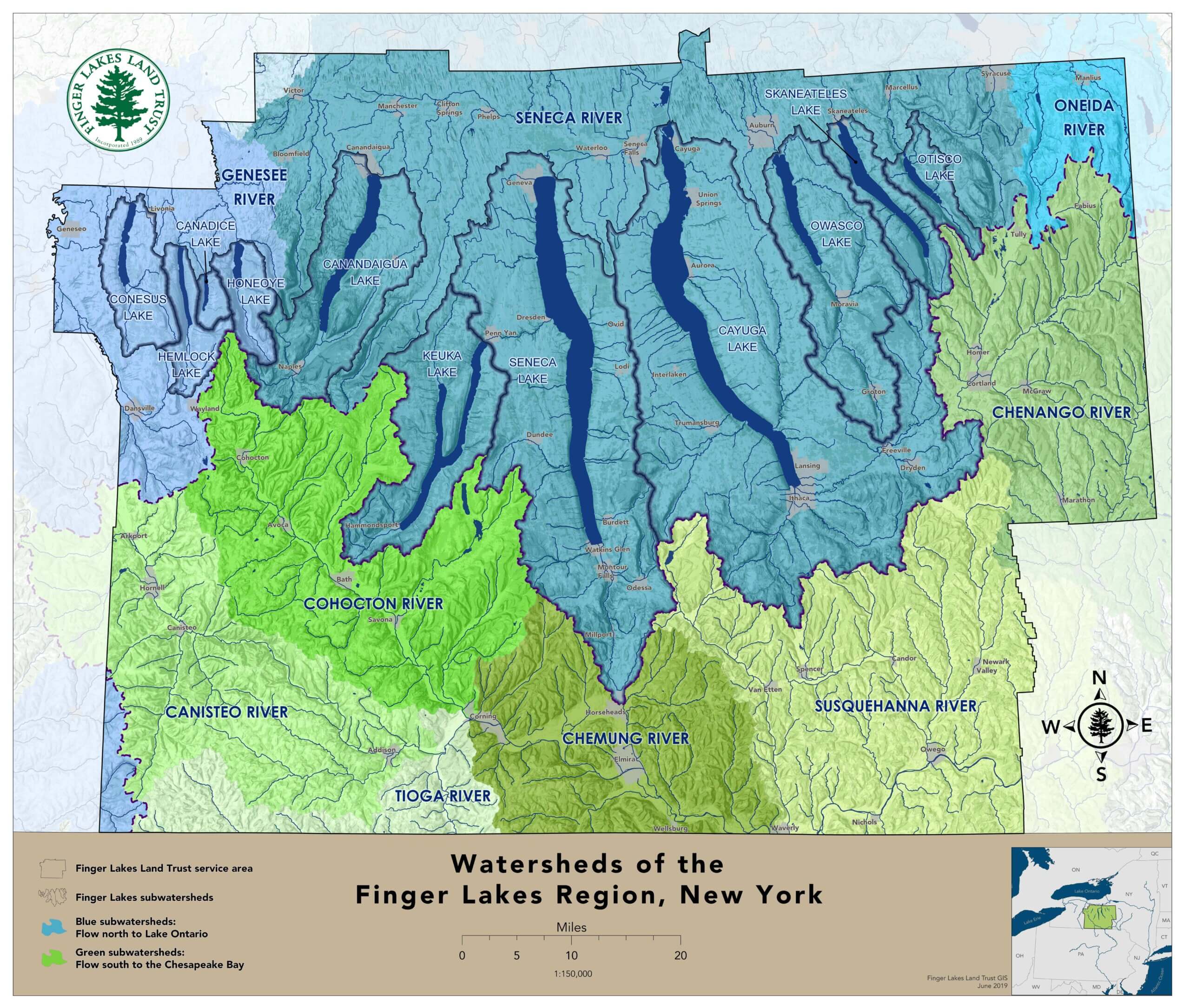
Also linked in the Downloads list is an informative land use map for the Cayuga Lake Watershed and a map of all the Finger Lakes watersheds both provided by the Finger Lakes Land Trust.

Downloads
Map of Cayuga Lake and nearby Finger Lakes
PDF, 2.3 MB
Map of the Cayuga Lake Watershed
by Karen Edelstein
JPG, 1.5 MB

Cayuga Lake Land Use Map provided by Finger Lakes Land Trust
JPG, 7.9 MB
Finger Lakes Watersheds Map provided by Finger Lakes Land Trust
PDF, 3.6 MB